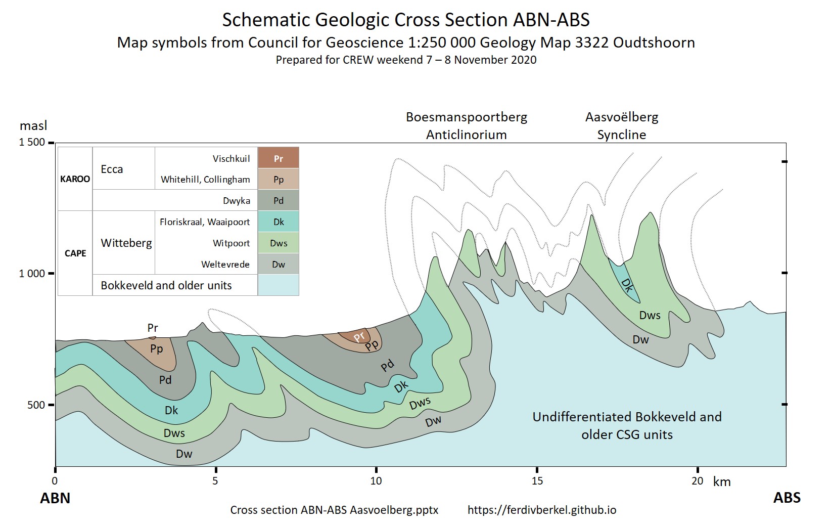
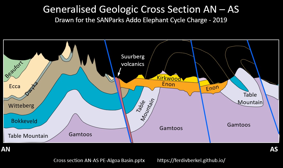
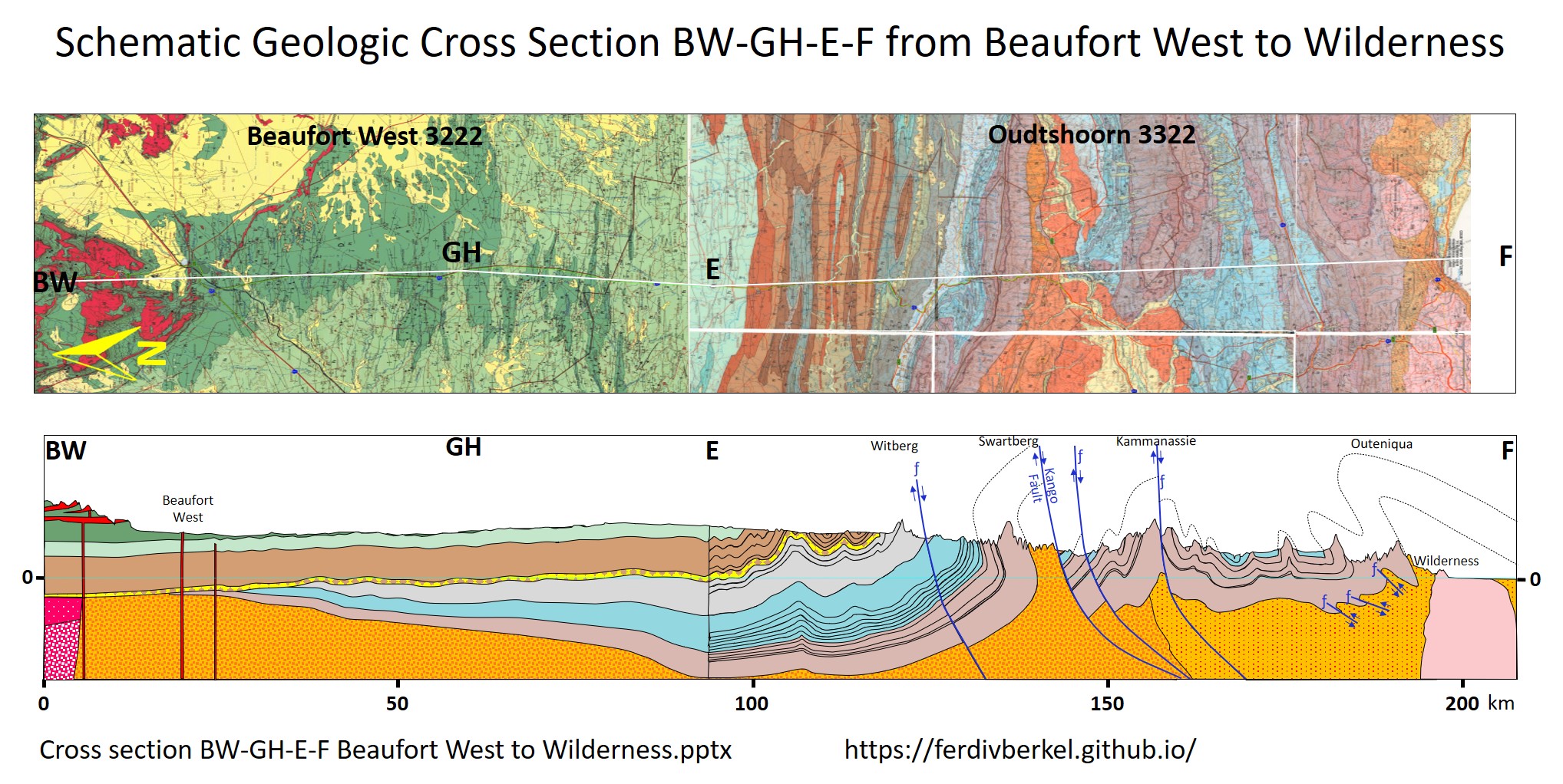
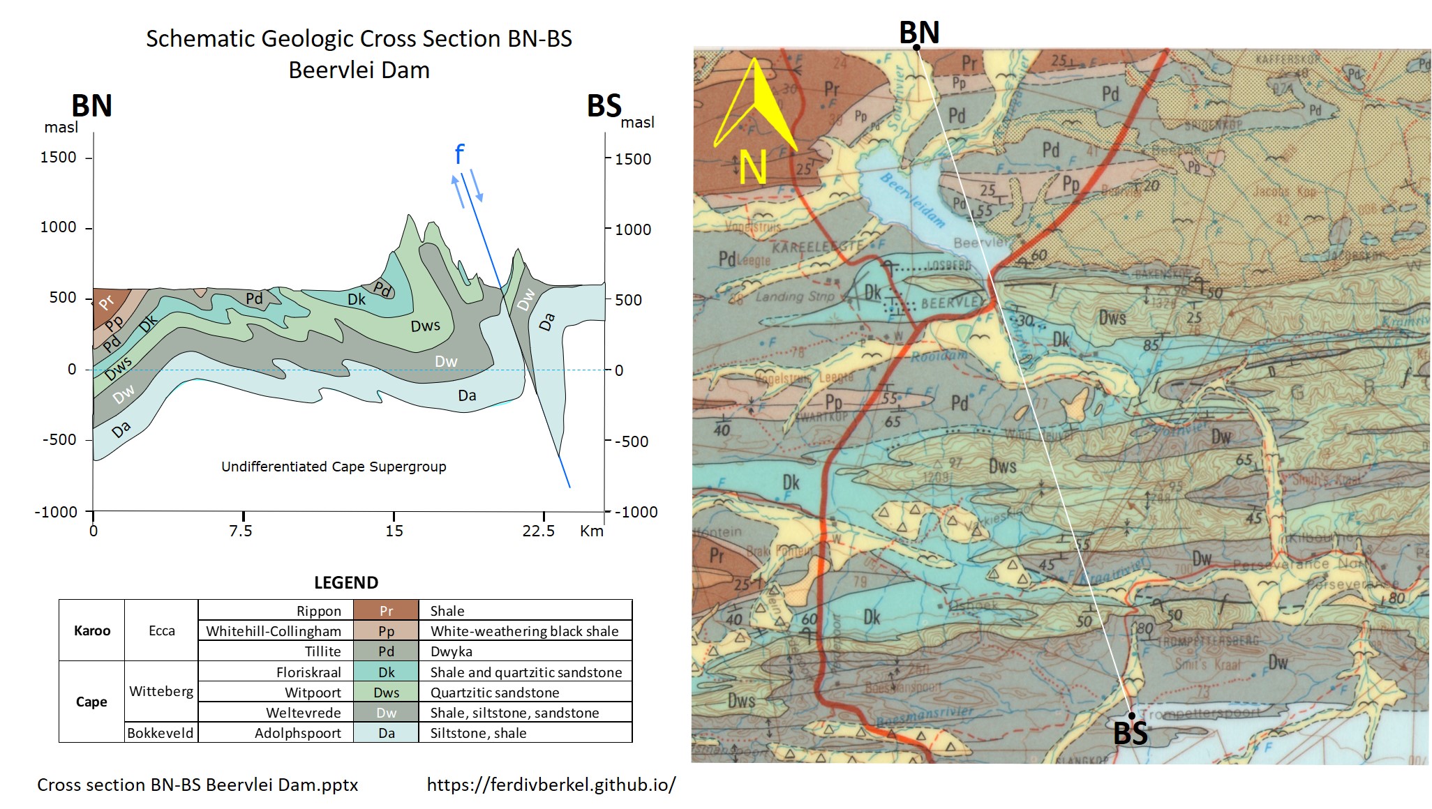
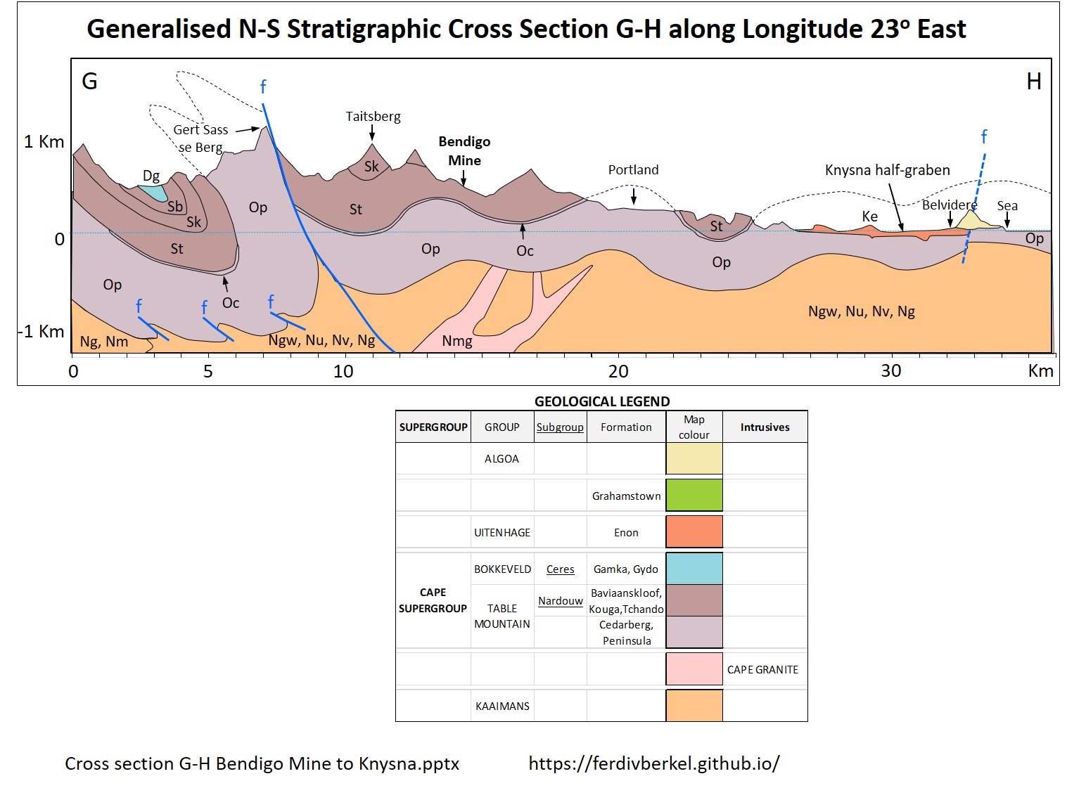
Explaining the evolution of the Cape Fold Belt to our Knysna U3A geology interest group during lectures and on field trips, is greatly facilitated by bringing out the three-dimentional nature of the crust using geologic cross sections drawn across the Council for Geoscience 1:250K geology maps. Unfortunately, neither the maps nor the Explanatory booklets accompanying the maps, have geologic cross sections.
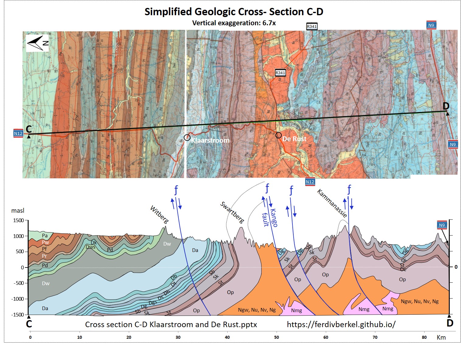
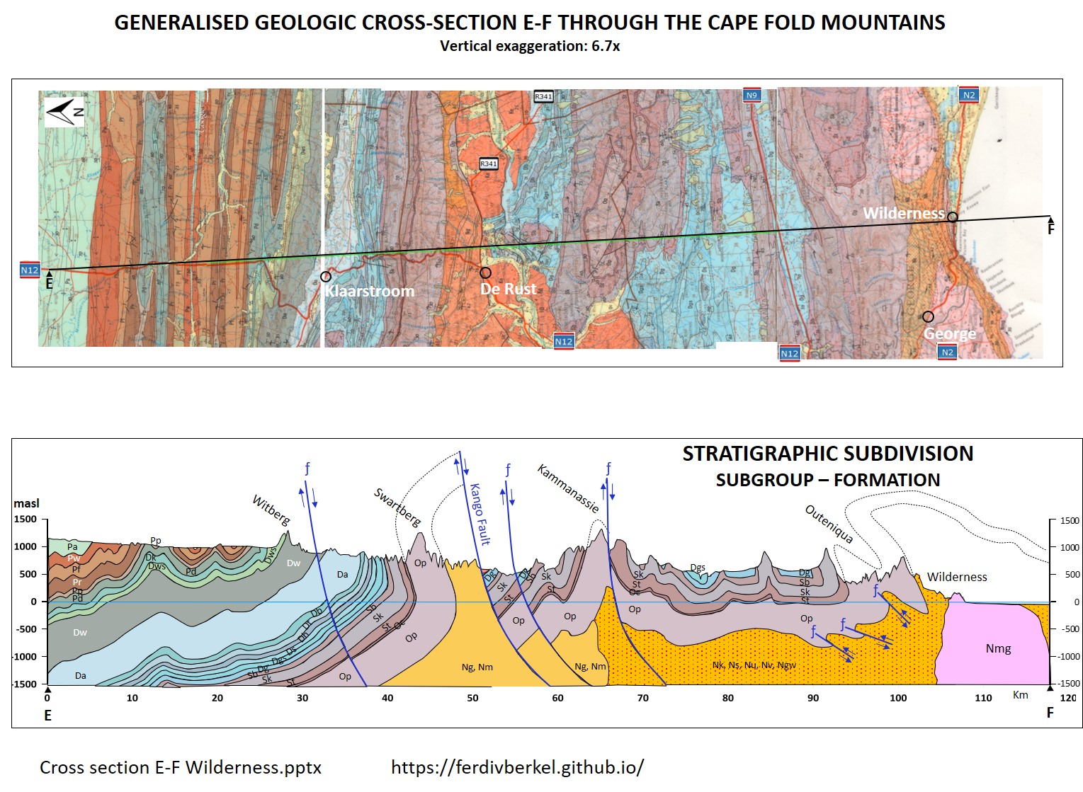
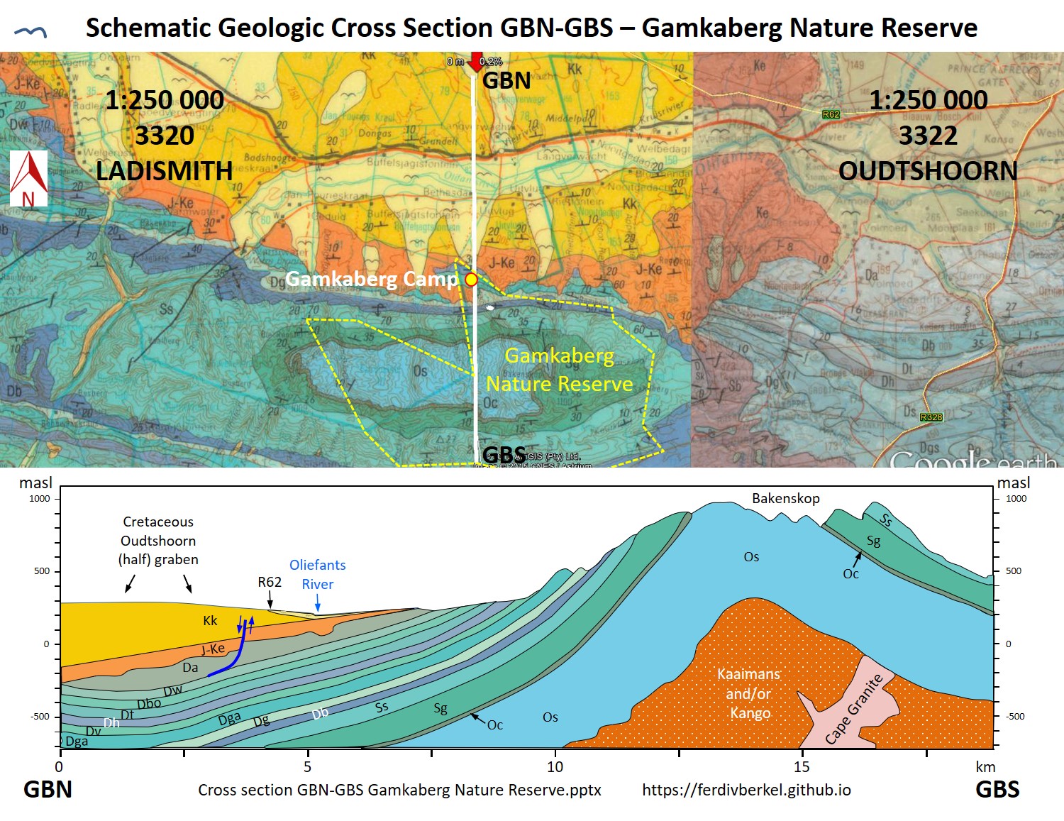
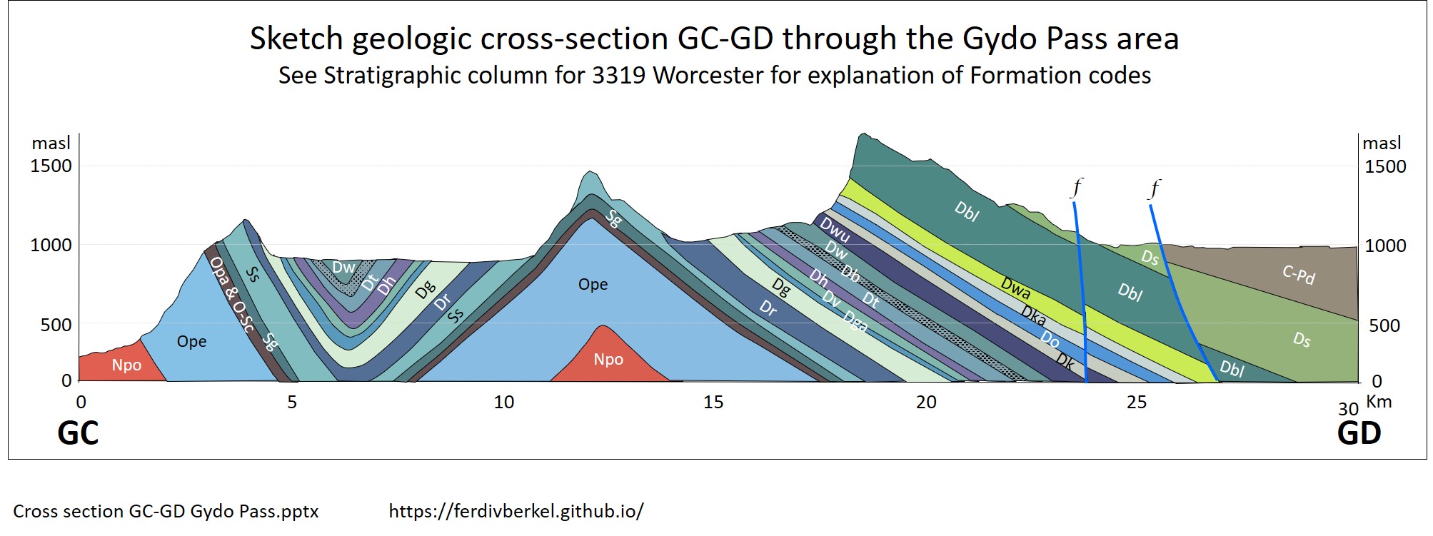
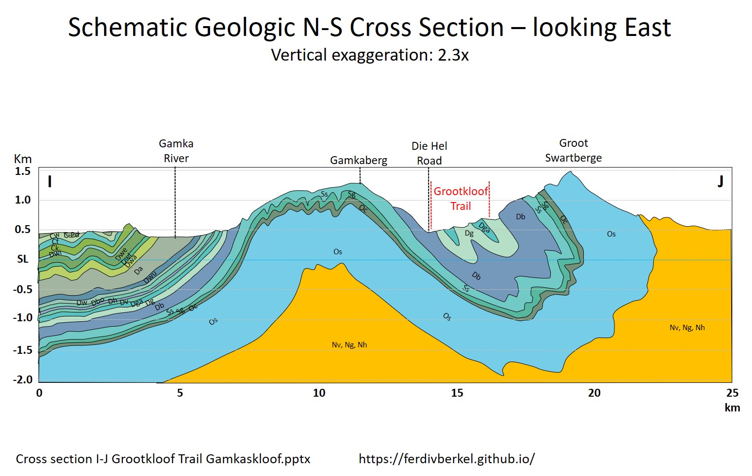
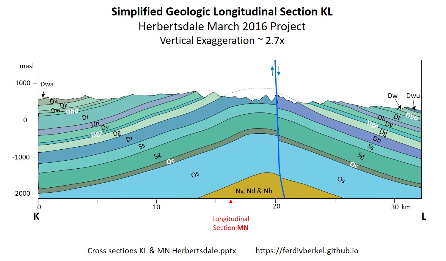
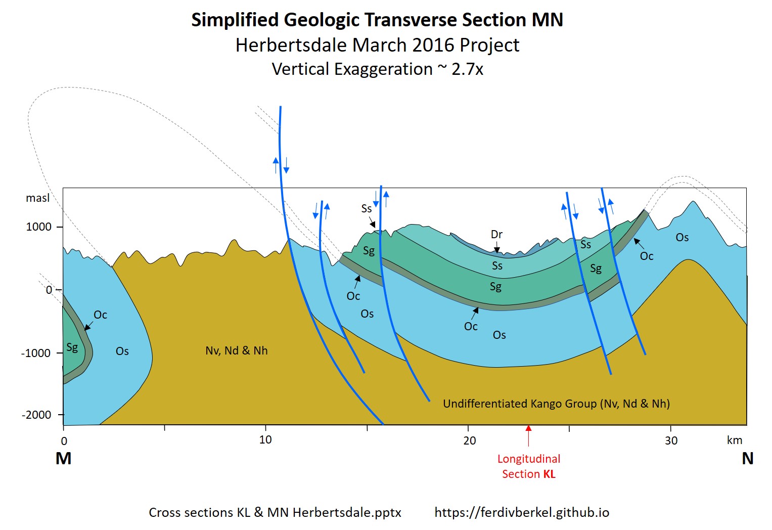
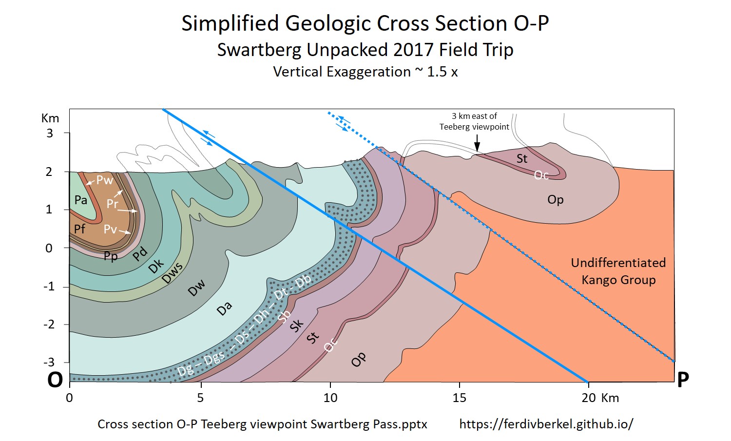
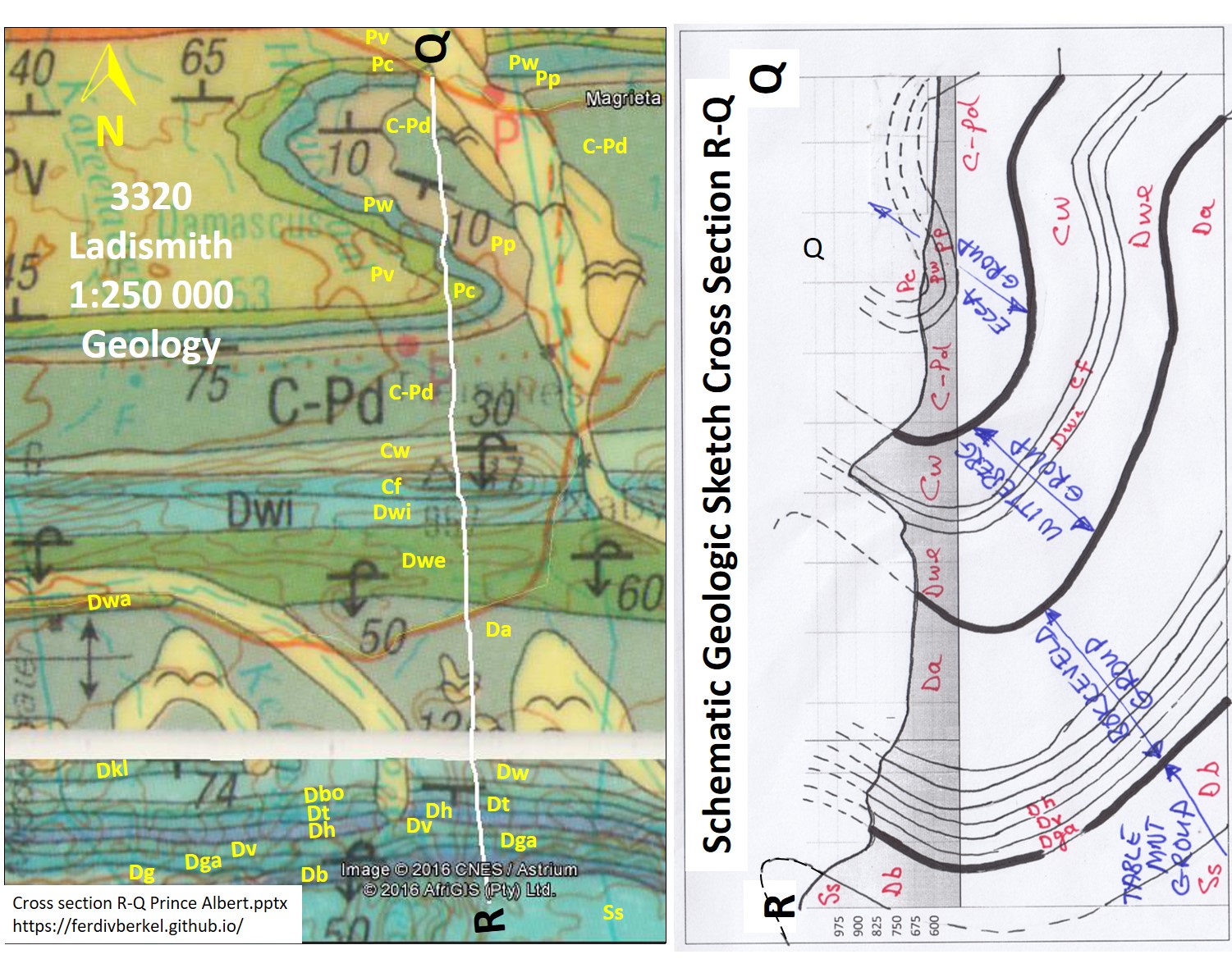
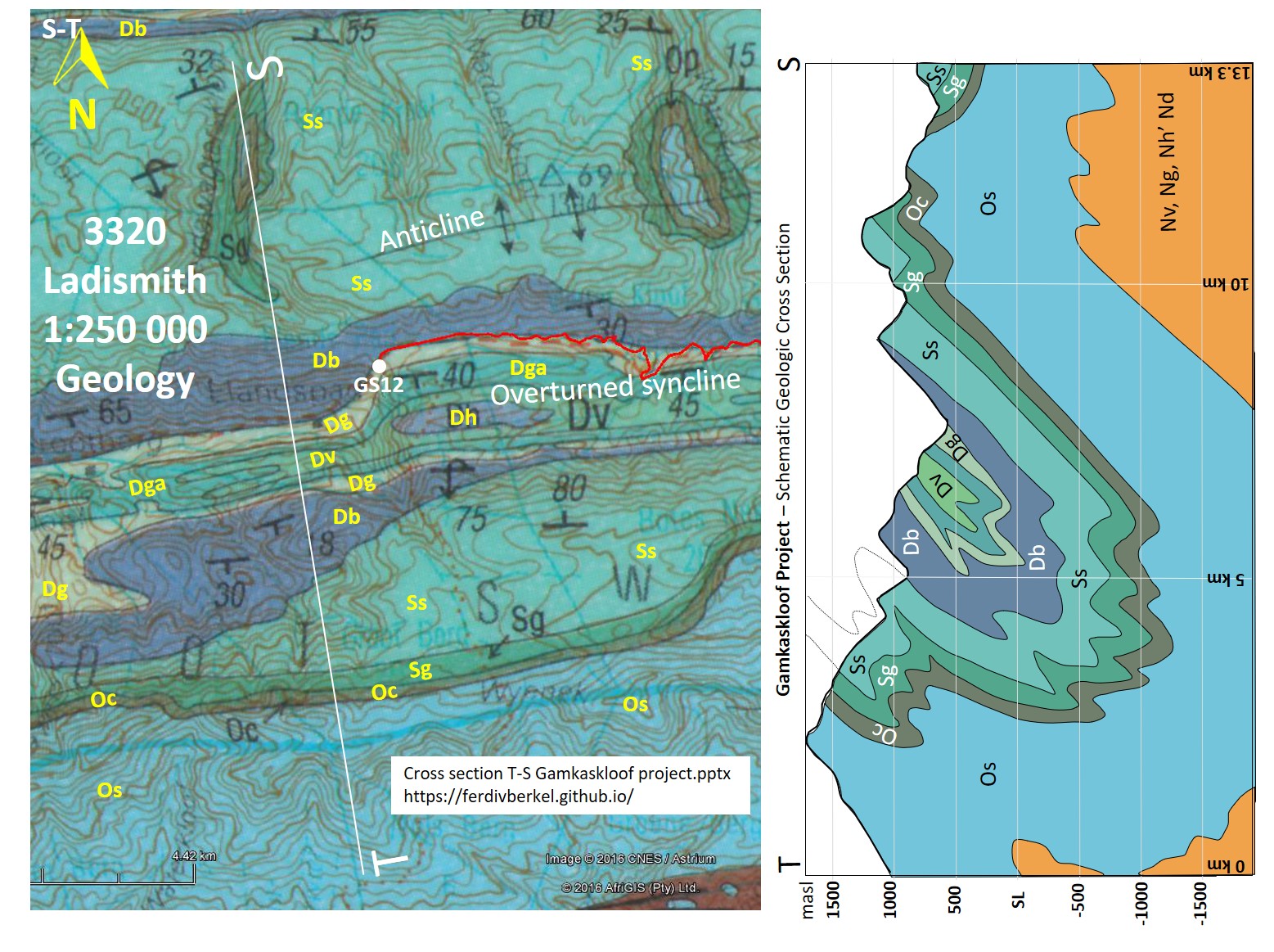
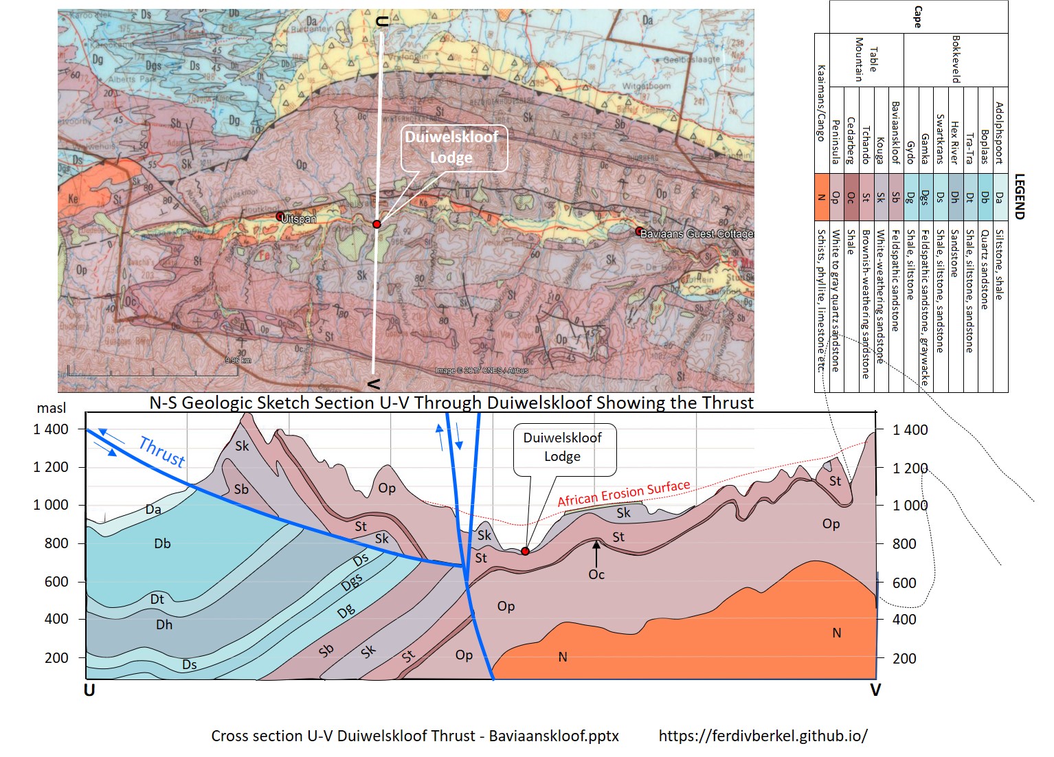
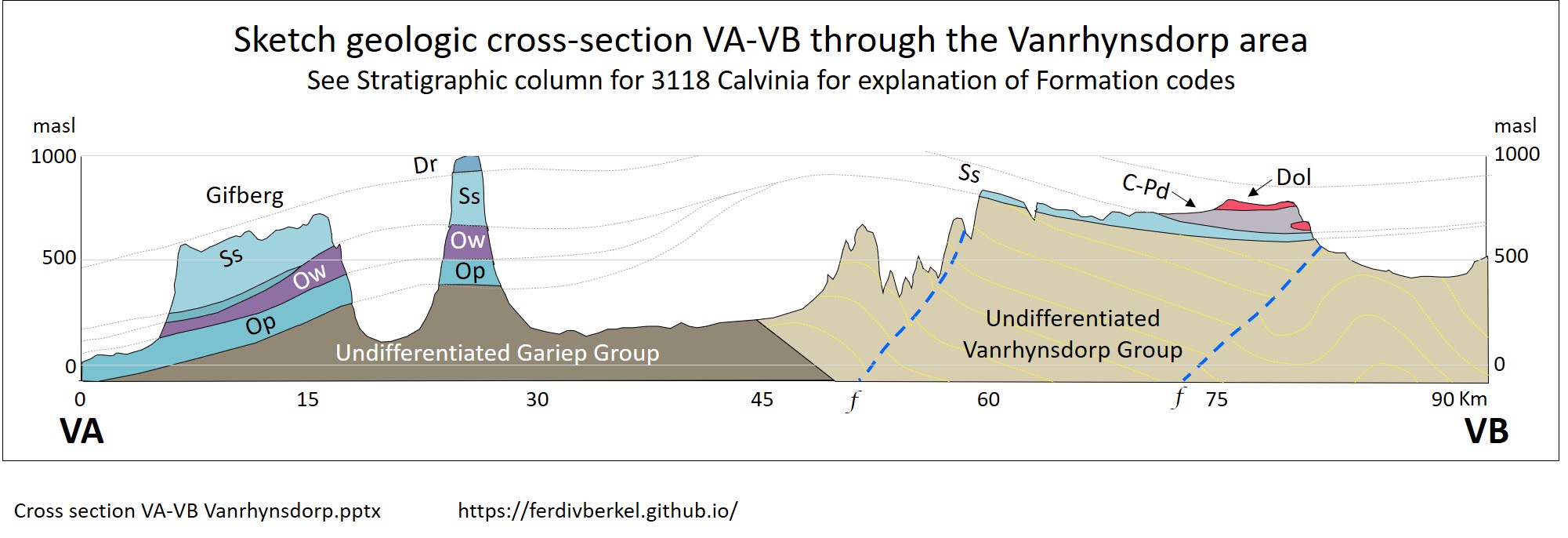
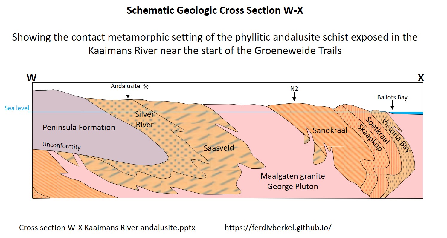
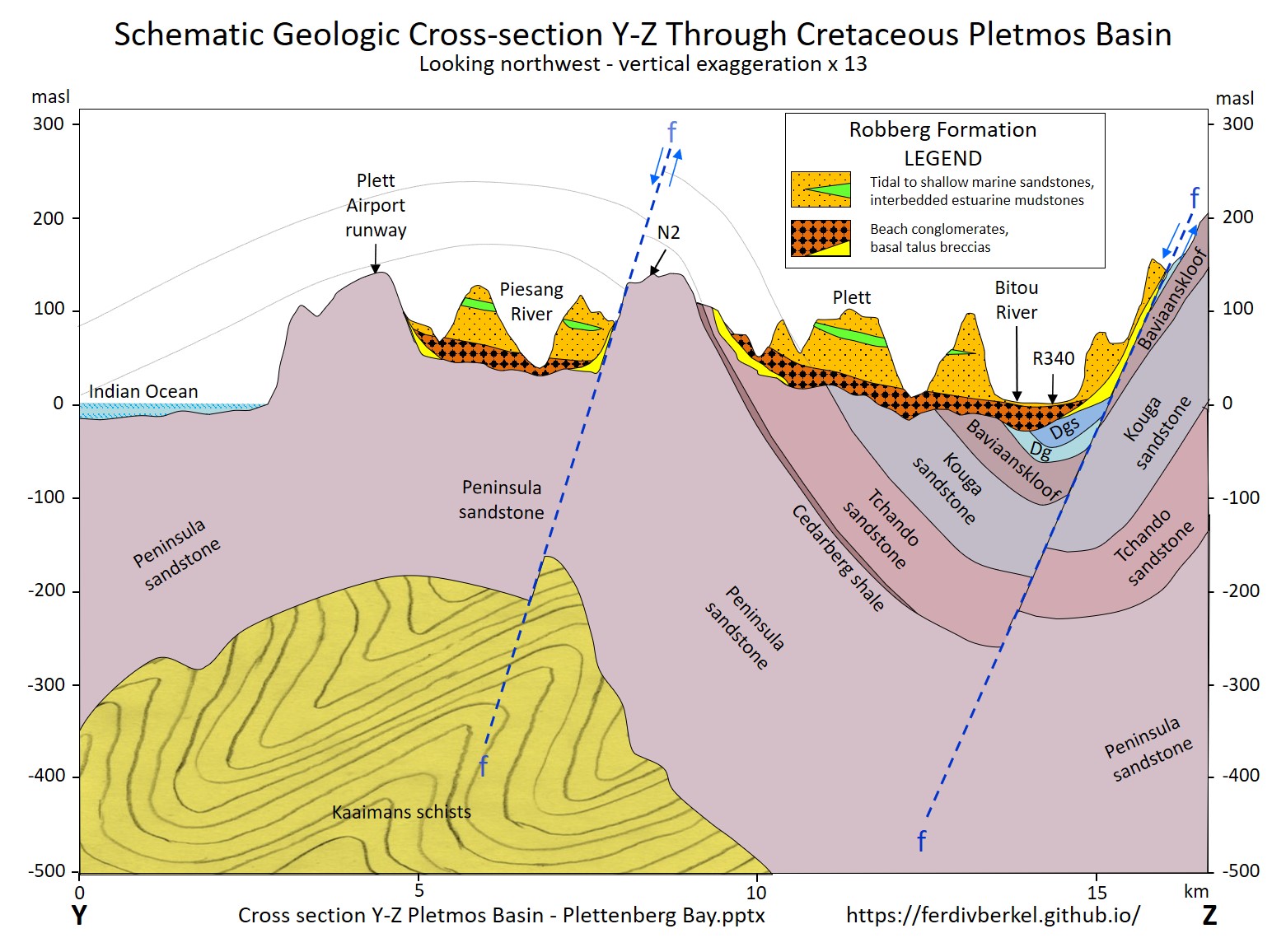
Sections are drawn using Google Earth, the 1:250K Council for Geoscience geology maps, and PowerPoint. Sections are not balanced and most have a >2x vertical exaggeration to bring out the structure of the fold belt.
The geologic cross sections below were drawn as part of the information booklets prepared for the Knysna U3A geology group day trips and longer excursions since 2014.
Updated 2 December 2020. Comments to fvanberkel2@gmail.com.
The geologic cross section line location and label files are in KMZ format for viewing in Google Earth. The individual cross section files are in PowerPoint. These files are not password protected and most are editable. You are free to use these geologic cross sections.
The cross sections in the PowerPoint files above are downloadable as small JPG files, useful for printing.